Glaciers are a historical part and creator of our mountains – they are living, moving phenomenon undergoing continual change. Unfortunately their survival is under threat and current generations should take time to experience, enjoy and study them. Being near to or on them requires experience, great skill and accurate judgement. Besides passing through the Norwegian Instructor Award for glacier instruction and guiding (Brefører), I have also amassed a great deal of experience of glacier travel, knowledge of glaciology and the mechanisms that surround glaciers in the mountains. This page is dedicated to some of the impressive glacial terrain there is to be found – particularly in Norway, where there are traditions for glacier travel for recreation dating back to the 1800’s – a tradition that is quite unique in the world. I am always happy to arrange glacier skills courses, lead scientific expedition groups and other bespoke glacier guiding when convenient for you.
Above, a warning sign on the approach to the Leirbreen glacier in Jotunheimen with the 2000m summits of Smørstabstindane arranged in a horseshoe behind. Below, a picture I took in 2024 from a vantage point a few hundred meters higher up the hillside. The glacier is now calving into a lake that didn’t exist in the photo above from 2008.
Below, the mountain lodge at Krossbu with the Smørstabbtindane mountains on the horizon. Krossbu is ideally located for glacier exploration, courses and summit ascents with glaciers Leirbreen, Bøverbreen, Smørstabbreen and Bjørnbreen only a short distance away. Krossbu is also easily accessible by public transport during the summer.
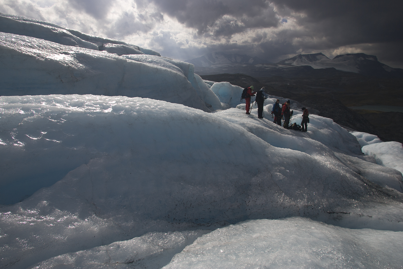
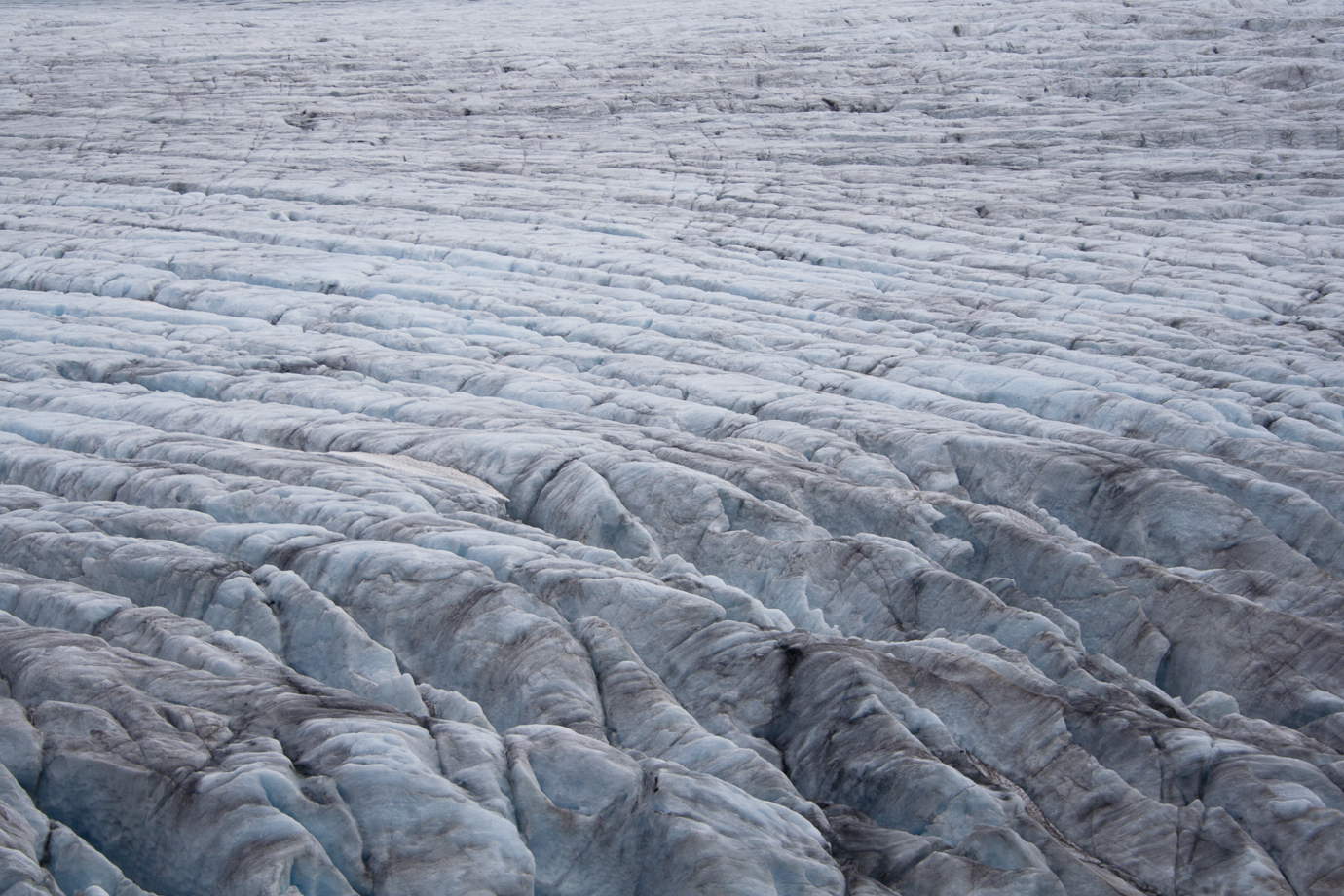
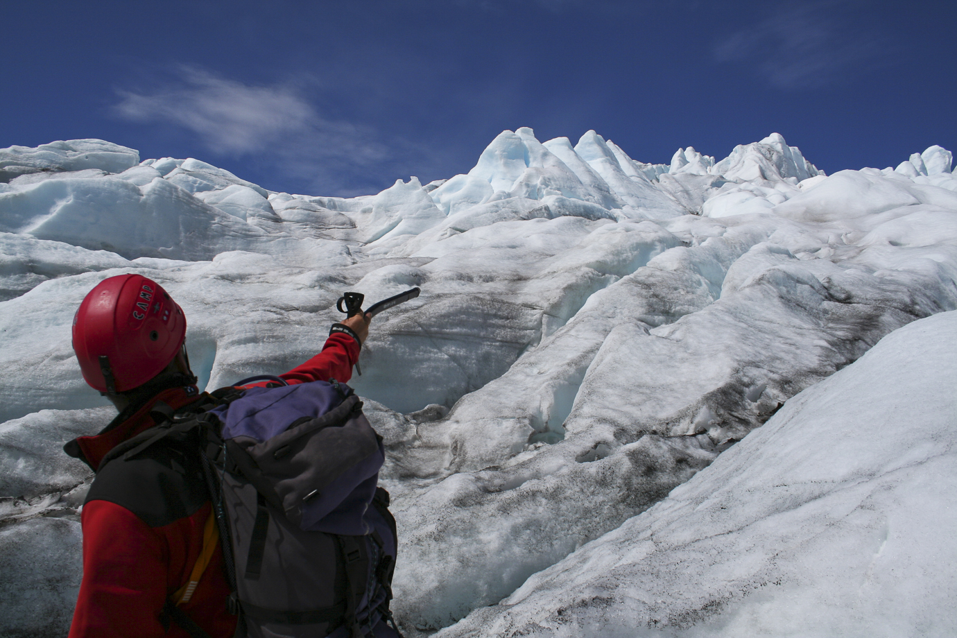
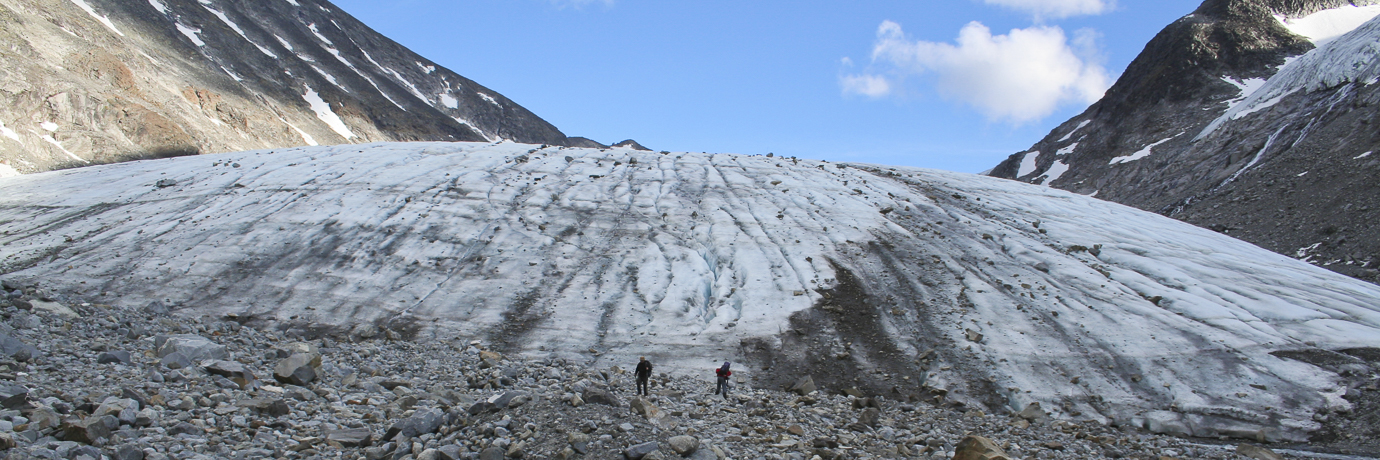
Below, an image carrousel with pictures from a wide range of trips and glacier courses in Norway over the years – from Bødalsbreen (Jostedalsbreen), Bøverbreen, Leirbreen, Svellnosbreen, Styggebreen, Rembedalskåka and Hardangerjøkulen. See the captions below the pictures.
Blue ice on Bøverbreen
Enjoyment while exploring glacial features
Ascending the icefall on Bødalsbreen
The foot of Blåisen on the edge of Hardangerjøkulen, near Finse
Glacier course on Bøverbreen
The icefield on Rembedalskåka
Navigating over Hardangerjøkulen
Descending Bødalsbreen
Mist on Styggebrean below Galdhøpiggen
Ice formations on Bøverbreen
Blue ice formations
Training first aid care after a crevasse rescue
The blue ice of Svellnosbreen
Despite glaciers and post-glacial terrain being cold, grey and generally inhospitable with life, there are many wonders of nature that exist there. Below, Glacier Crowfoot (or Buttercup) Ranunculus Glacialis or Issoleie in Norwegian, is a pioneering perrenial herb that is found widely in post-glacial terrain and near the highest summits. Once it’s seed has germinated, it can take 7 years before the plant has gained enough energy to produce the first flower. The petals turn pink after pollination.
Below left, a plaque to commemorate Knud O. Vole at Juvasshytta. Knud who was one of the pioneers of mountain exploration and tourism in the late 1800´s in Jotunheimen. He became a DNT Patentfører in 1889 – one of only a handful of mountain and glacier leaders appointed at the time. Legacies of his time still stand today and they attract thousands of tourists each season who come to ascend Norway’s highest summit – Galdhøjpiggen 2469m. Juvasshytta, located at 1840m at the end of a tarmac road from the valley, has 144 beds in 50 rooms and was originally established by Ole Vole in 1884 – then with 4 beds. The first hut on the summit was complete in 1888, however it took a number of attempts before the final (current) construction from 1975 could stand the test of the summit storms. The map below right shows how Storbreen in the neighbouring valley of Leirdalen has receded from 1785 to 1996. The outermost and lowest moraine shows how the glacier reached the river in 1785. Now the glacier has split into two arms near the nunatak pictured at 1675m – a recession of more than 400 vertical metres. I have also witnessed the changes over the last 30 years.
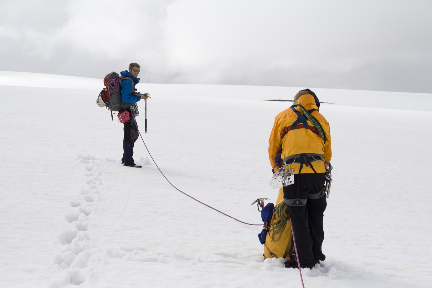
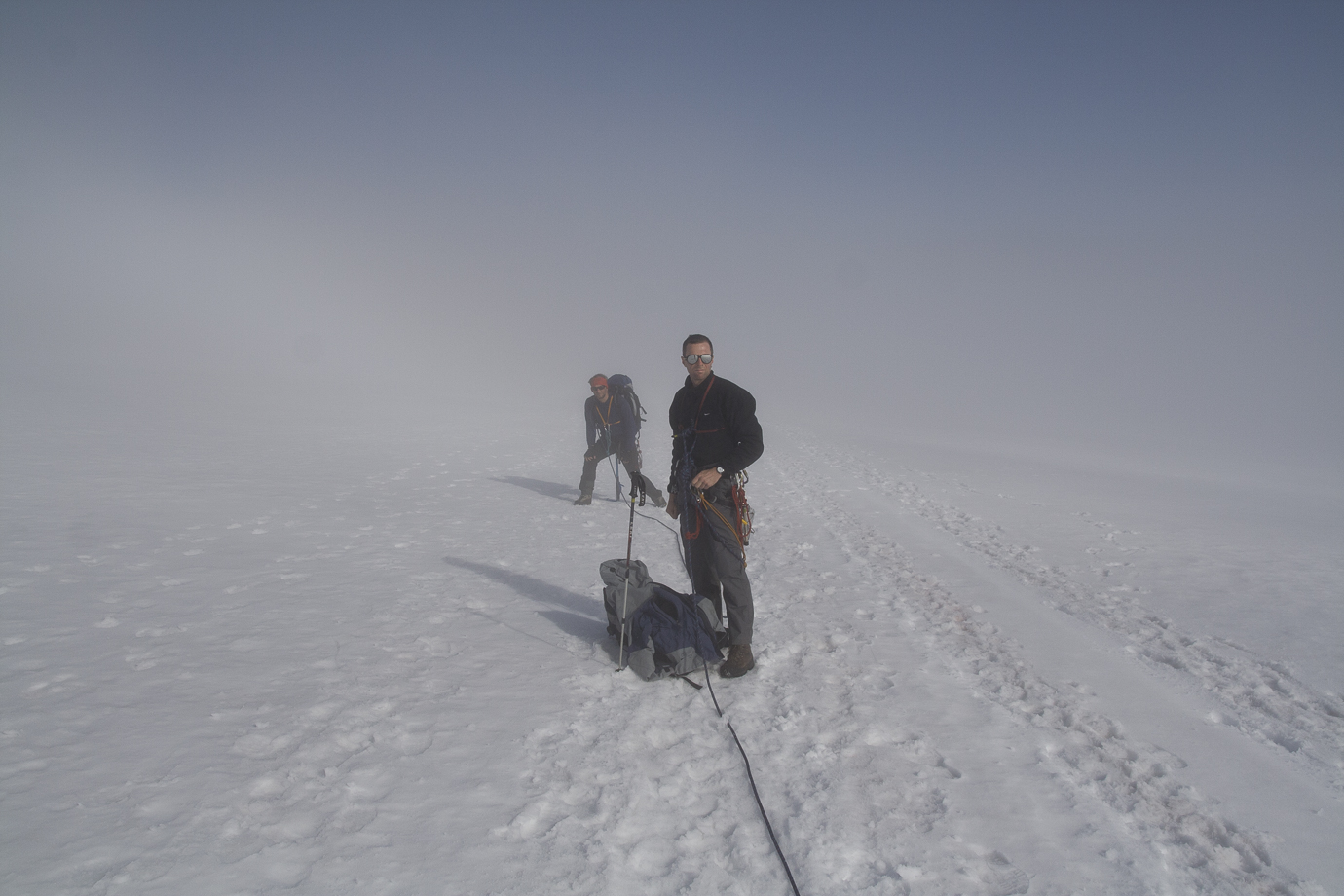
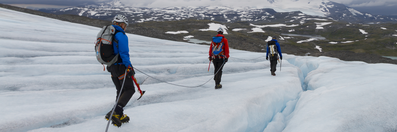
A good selection of equipment and skills is necessary to keep you safe while moving on glacial terrain. Above left, a typical toolbox for a dry glacier tour including helmet, axe, crampons, harnesses, rope, quickdraws, ice screws, prusiks, pulleys, belay device and gloves. Above right, picking a suitable axe length and weight is important – lightweight is not good. Below, tying-in to the main rope using a shorter length of cord between sit and chest harnesses without using a karabiner. Below right, moving together on a snowy slope when the axe can be used habitually by group members as an intermediate anchor. Appropriate sunglasses are also extremely important.
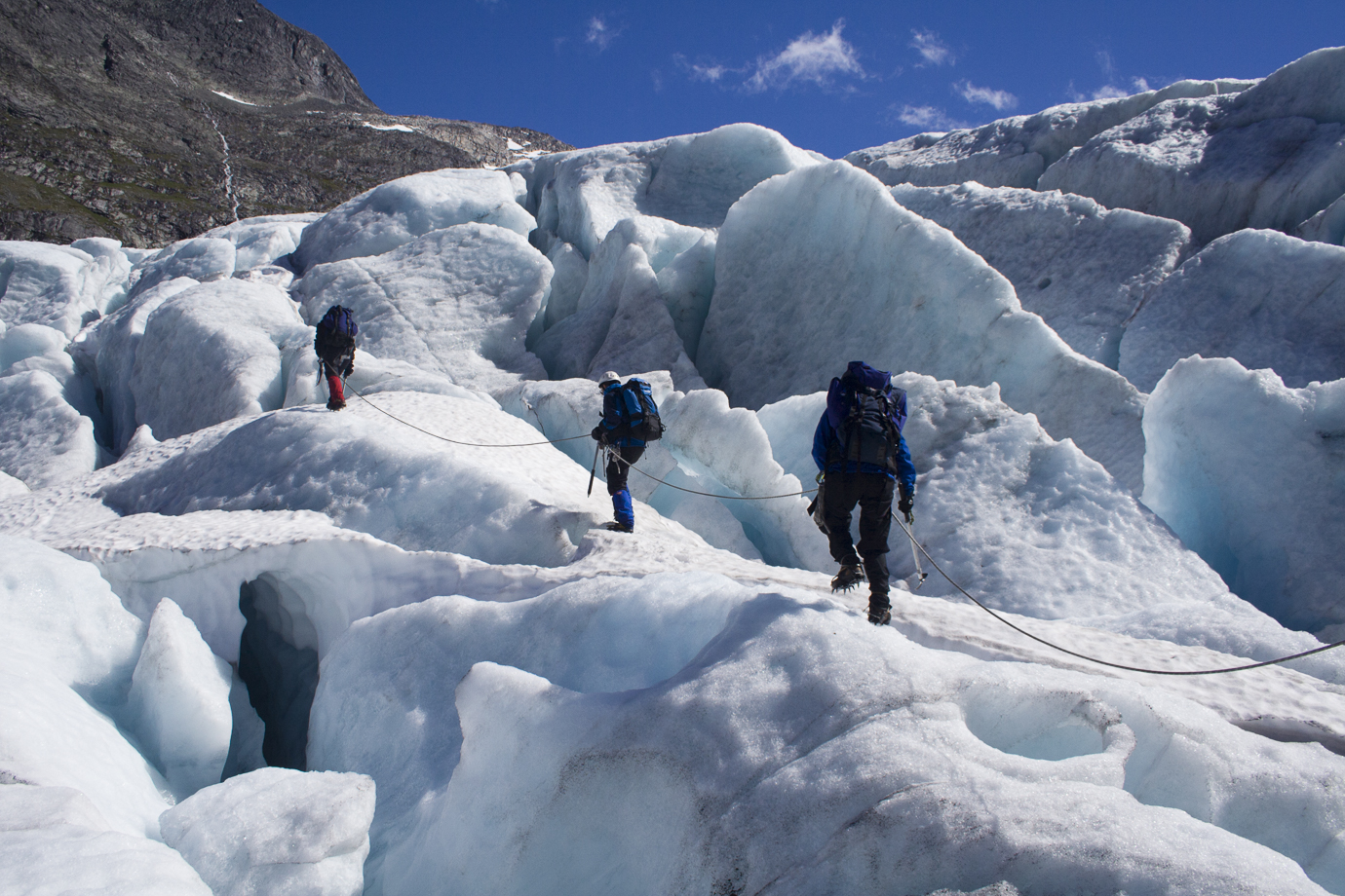
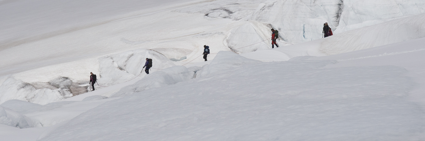
The two pictures below illustrate how wildly different glacial terrain can be – from a reasonably flat, uncomplicated snowfield to a complex system of deep crevasses and ice bridges. Techniques and equipment are adjusted to match the terrain and snow cover – and it also requires different skills and experience of all the group members.
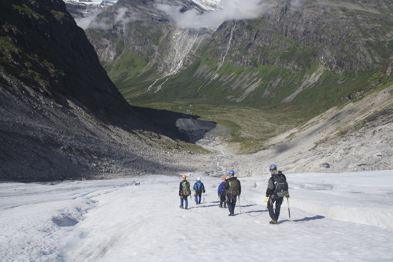
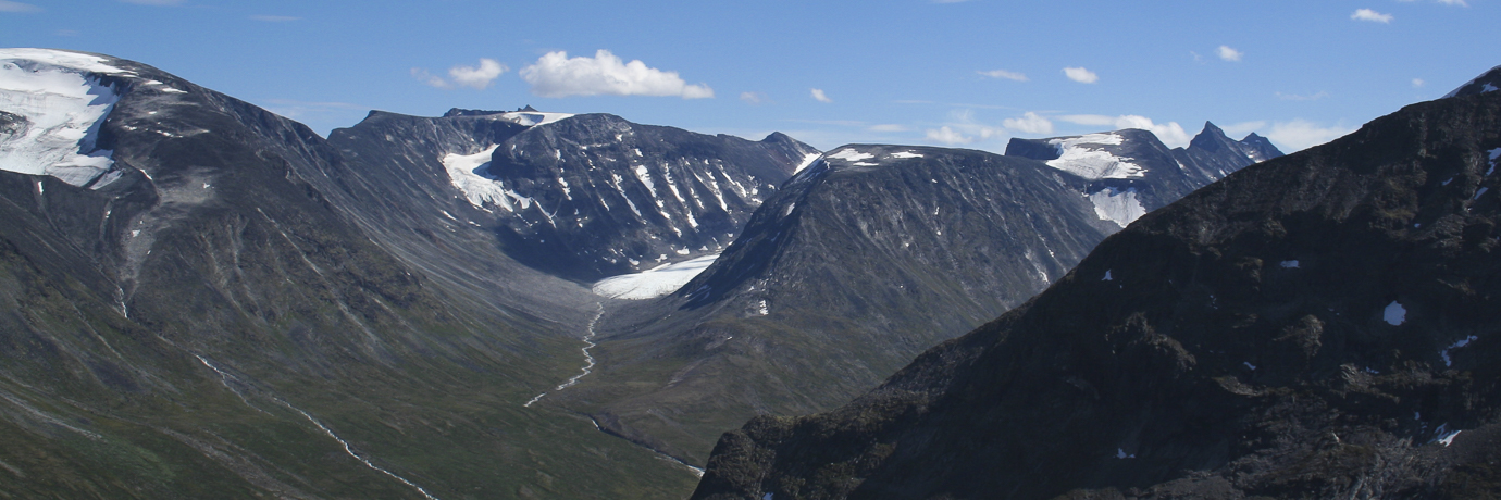
Below, four pictures showing a group crossing the ice cap Hardangerjøkulen in Hardangervidda, a group descending Veobreen, a fine summer view across Visdalen towards the glacier tongue of Hellstugubreen 7km away and finally, close up below the tongue itself some 300m across.
Descending Veobreen southwest of Glitterheim
Crossing Hardangerjøkulen
The view across Visdalen from Svellnosbreen to Hellstugubreen
The tongue of Hellstugubrean close up, 300m across
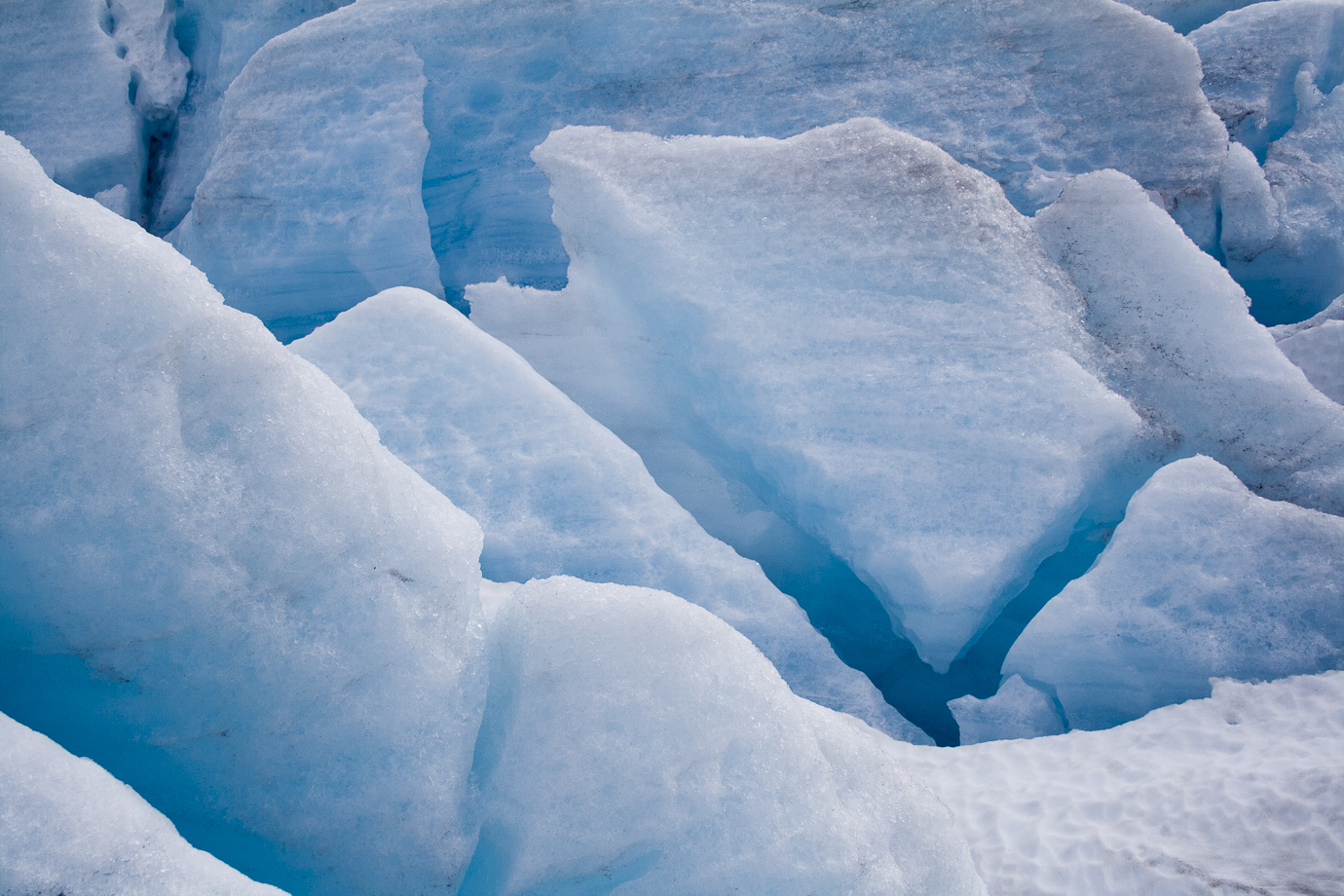
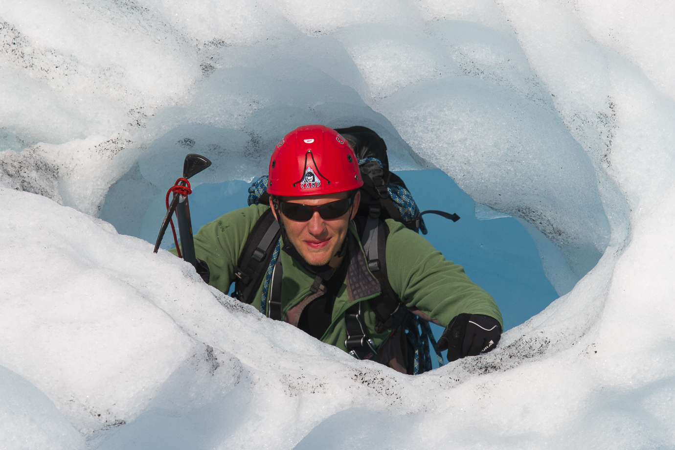
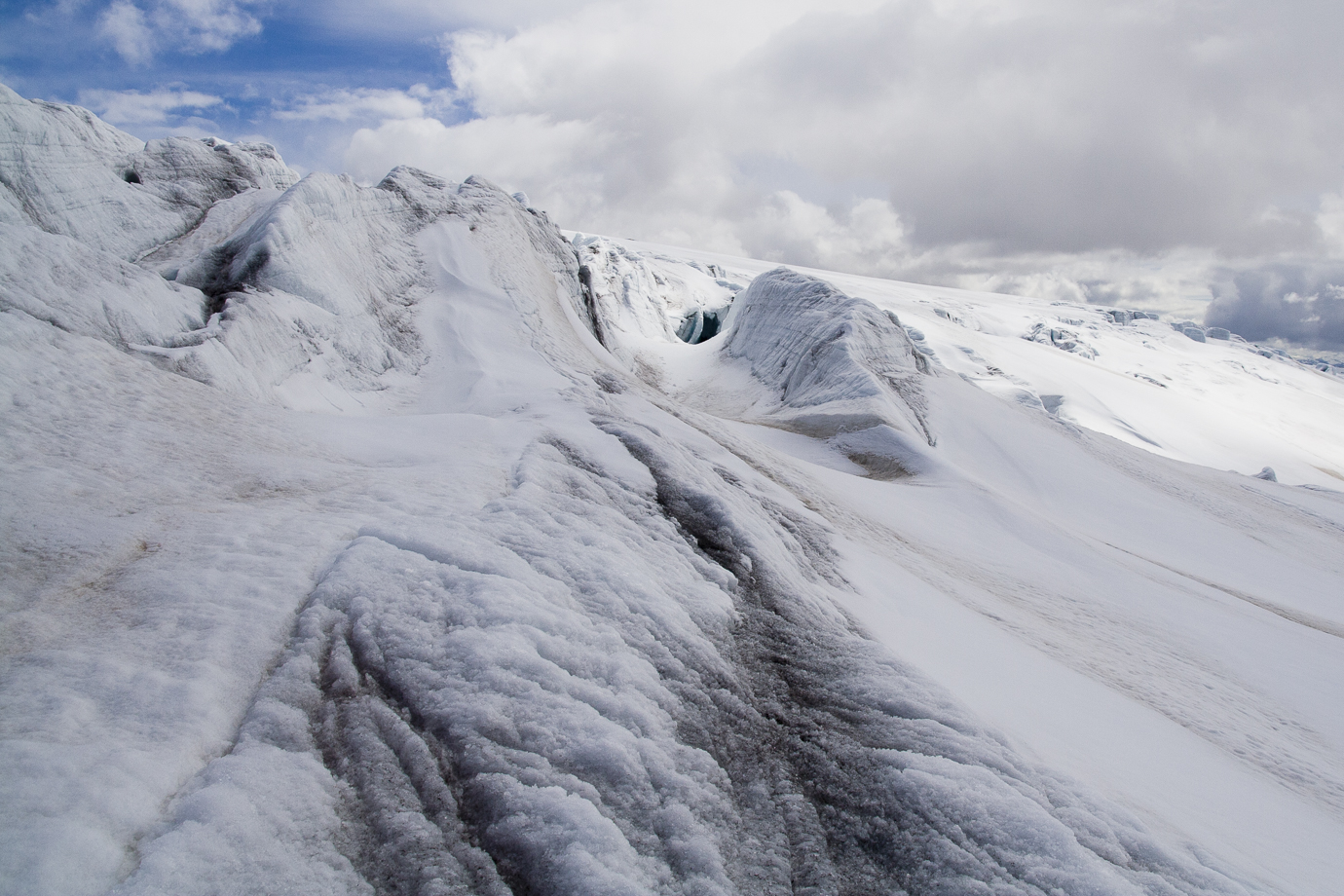
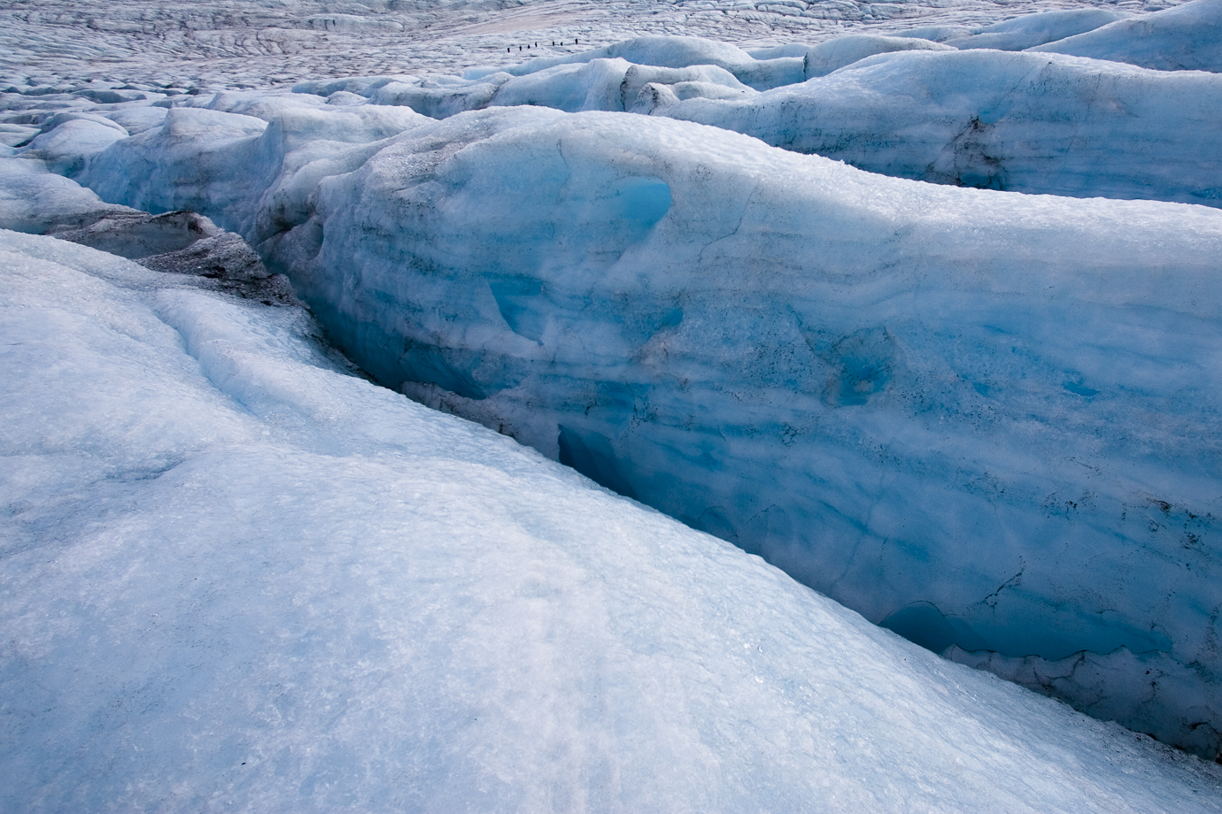
Fascinating glacial features either caused by the plastic movement of the ice, by the wind and melt-freeze cycles or running water. Below left, a safe channel open at both ends allows for exploration and a view from almost inside the ice. Below right, a very dangerous feature of glaciers – a moulin, or ice well – where surface water channels its way into the depths of the glacier. These features can be covered by snow. It is easy to see why wearing a rope and suitable foot traction is absolutely necessary.
Below, the fascinating glacial arm of Rembedalskåka on the western side of Hardangerjøkulen. The approach to the DNT hut Demmevasshytta which is perched on the rock out of picture to the right involves leaving the plateau at around 1600m and descending the footpath in picture left before crossing the glacier above the lake. The area here is steeped in history. The hut was originally built in 1896 for workers who built a tunnel through the bedrock to lower the level of the lake pictured. This was to prevent catastrophic floods if the lake broke through the ice. The original tunnel is now several hundred meters up the rock face and later, a lower tunnel was also constructed.
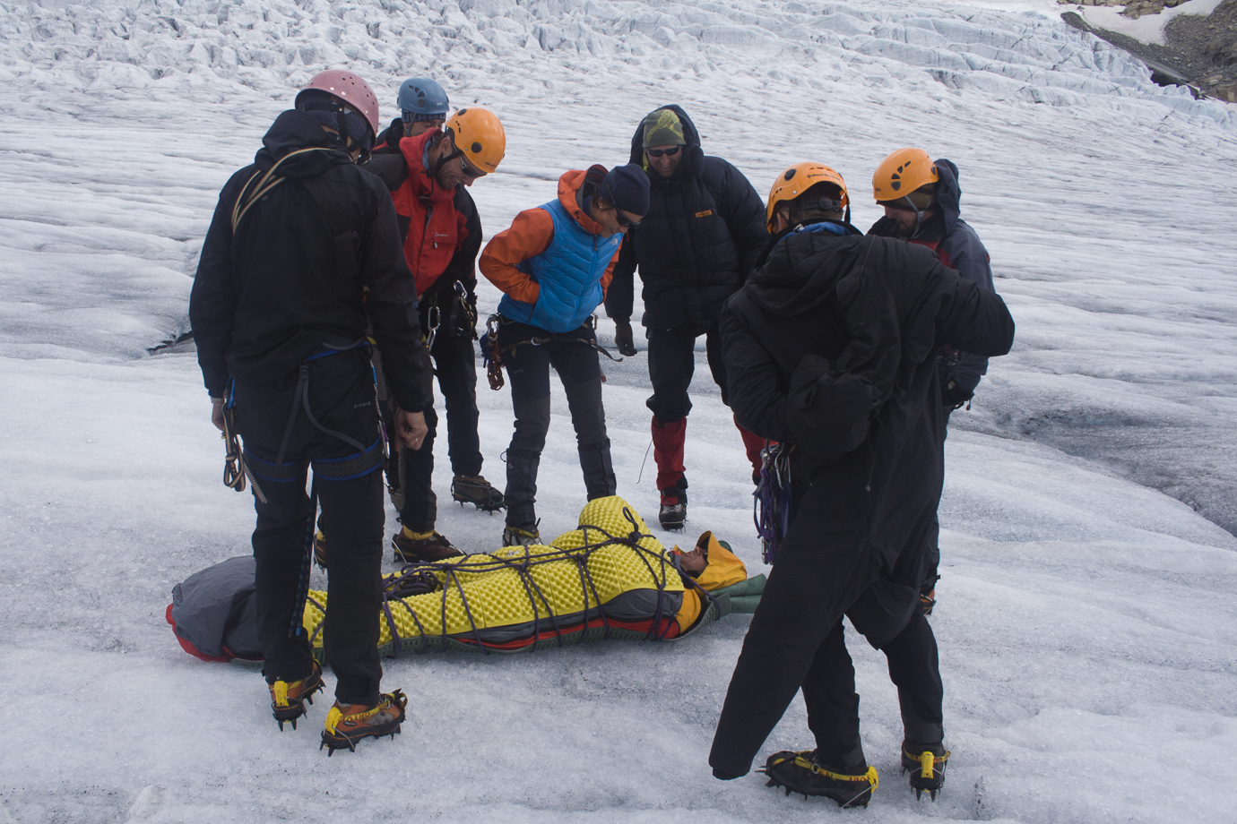
Above, practicing movement on ice wearing crampons with the ‘French-technique’ where the sole of both boots stays flat on the ice. Below, practicing crevasse rescue with an ‘unlucky’ volunteer. Fortunately the weather was very favourable.
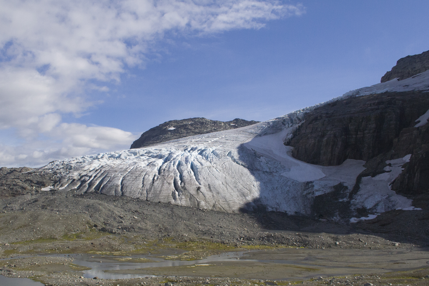
Above, glaciers tend to make you feel very small. Above right, traversing Bjørnbreen from the pass of Bjørnskardet to the summit of Storebjørn (2222m). This popular and iconic summit that looks like the ears of a bear, can only be reached by a fairly long glacier traverse. The summit is about 1km distant from our position. Later in the season a large crevasse opens up below the rocky knoll on the righthand ridge blocking access. Below, approaching Svellnosbreen above Spitersulen in central Jotunheimen. The icefall is very popular with guided tours because of the relative short access – however, the last 400m of ascent are up this moraine ridge that has a gradient of ~40 degrees.
Finally on this page, the picture above shows a glacier surface on Iceland and in particular a large ‘ash cone’ where volcanic ash has collected and prevented the ice from melting at the same rate as the surrounding area. This results in a cone of ice covered with a layer of ash. On most glaciers in non-volcanic regions, these cones would be ‘sand cones’ where ordinary debris such as rock dust and sand would have the same effect. Below, looking across the Imja Glacier at 5150m with Baruntse in the mist back left. The entire glacier is covered in a thick layer of debris. To the right you can see the upper part of Imja Tsho where there has been a danger of sudden flash floods for many years and the status of the lake has been under surveillance. Unfortunately, the lake now extends across most of this picture.